
Digital Twin
A City Information System that shows the current and future situation and looks at history. Know where vehicles will be in real time.
Digital Twin
Test tomorrow's traffic before it happens
A Digital Twin is a software model of pedestrian, cycle and vehicle movement across your city. Change signal timings and traffic plans in the model — live or against historical data — and see the effect before anything touches the real network.
What it is
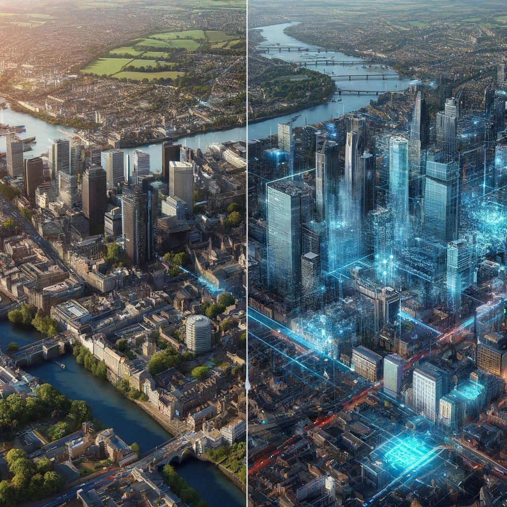
A working copy of your city
The Digital Twin models your city junction by junction. A live simulation forecasts traffic one to three hours ahead and lets you change signal timings to see the effect; a historic simulation replays past flows so plans can be tested and refined. Improvements proven in the model are rolled out to the Urban Traffic Control (UTC) and Urban Traffic Management and Control (UTMC) systems.
Why it matters
Act on the next hour, not the last one
Conventional traffic management reacts to what has already happened. The Digital Twin forecasts where vehicles entering the city will go and when they'll arrive, so problems can be anticipated and the traffic plan changed before congestion forms — by city managers, or by the AI directly. The same forecasts extend to air quality, so beneficial changes can be adopted before an exceedance occurs, not reported after.

Patented technology
Junctions that know what's coming
NOW Wireless holds a patent for a method and system of predictive traffic flow and traffic light control. Wireless and CCTV sensors feed an AI that tells each junction what traffic it will receive from five minutes to an hour or more before it actually arrives — the foundation that makes a true Digital Twin possible, and lets city management adjust plans pre‑emptively or hand control to the AI.
Route probability
Every vehicle, a predicted path
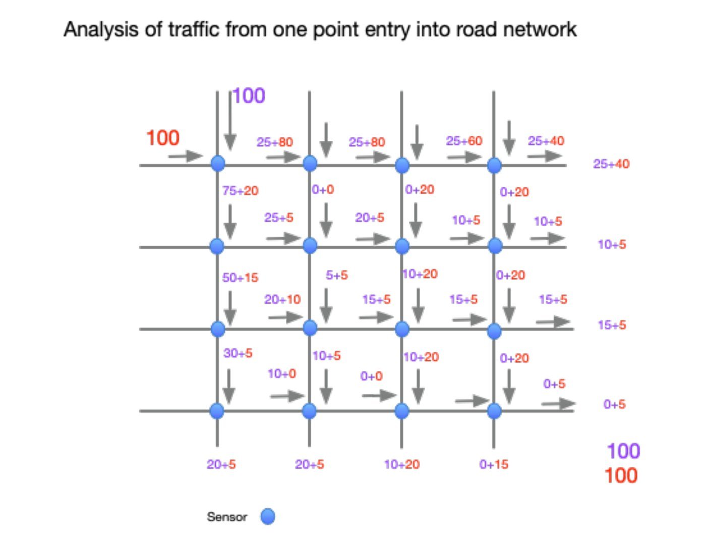
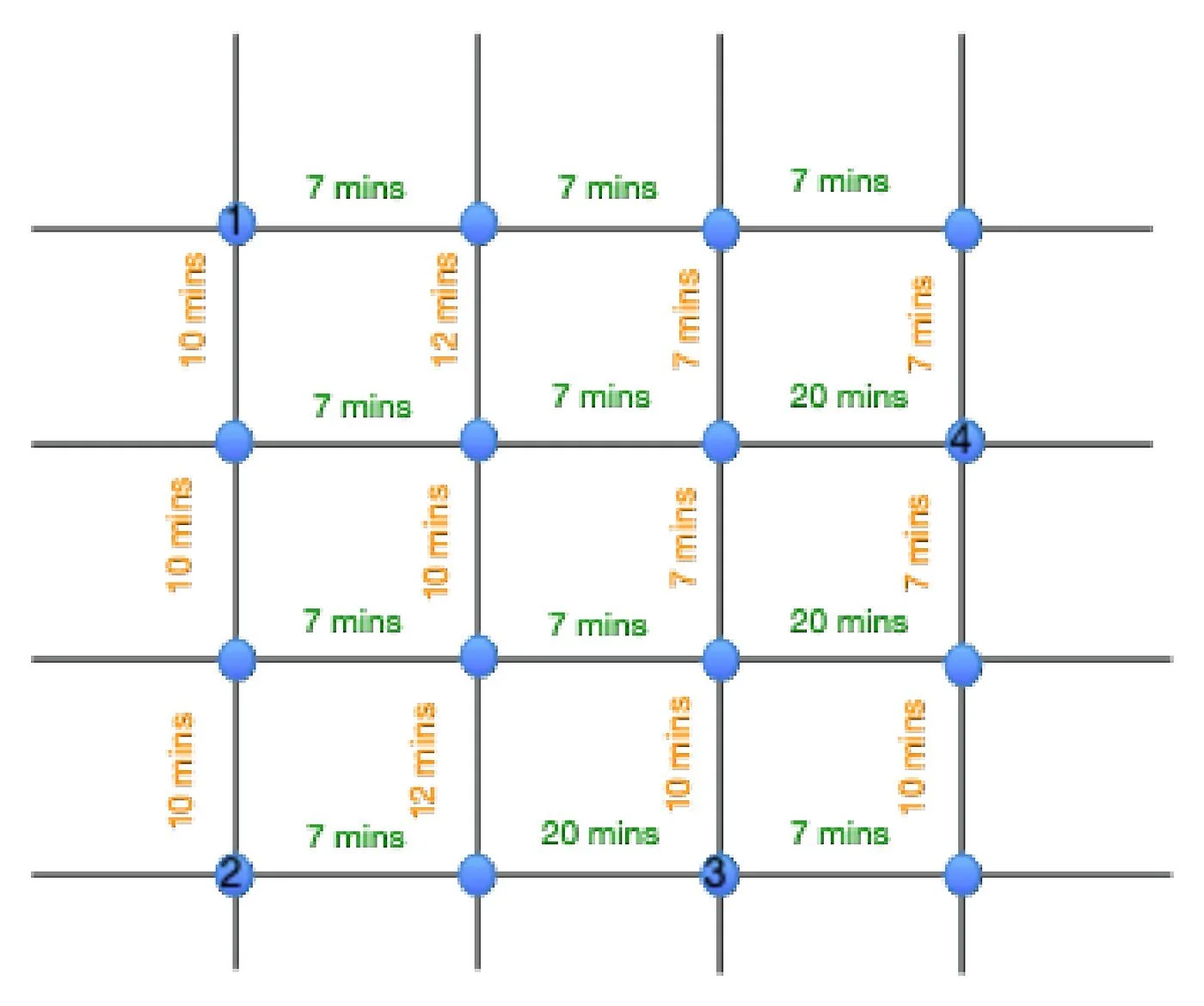
As a vehicle enters the city, the AI assigns a probability to every junction it may pass through — and refines it at each junction as the journey unfolds, so accuracy increases along the way. Aggregated across every vehicle in the city, these probabilities build an accurate forecast of vehicle counts at every junction in the network.
Journey time
From probability to arrival time
The AI calculates journey times for every vehicle moving through the city, updated second by second. Combining route probability with journey time turns forecasts into arrival times — when vehicles will reach each junction and which exits they'll use — so signals can be optimised and plan changes made an hour or more ahead, by the AI or by city managers.
System inputs
Trained on billions of journeys
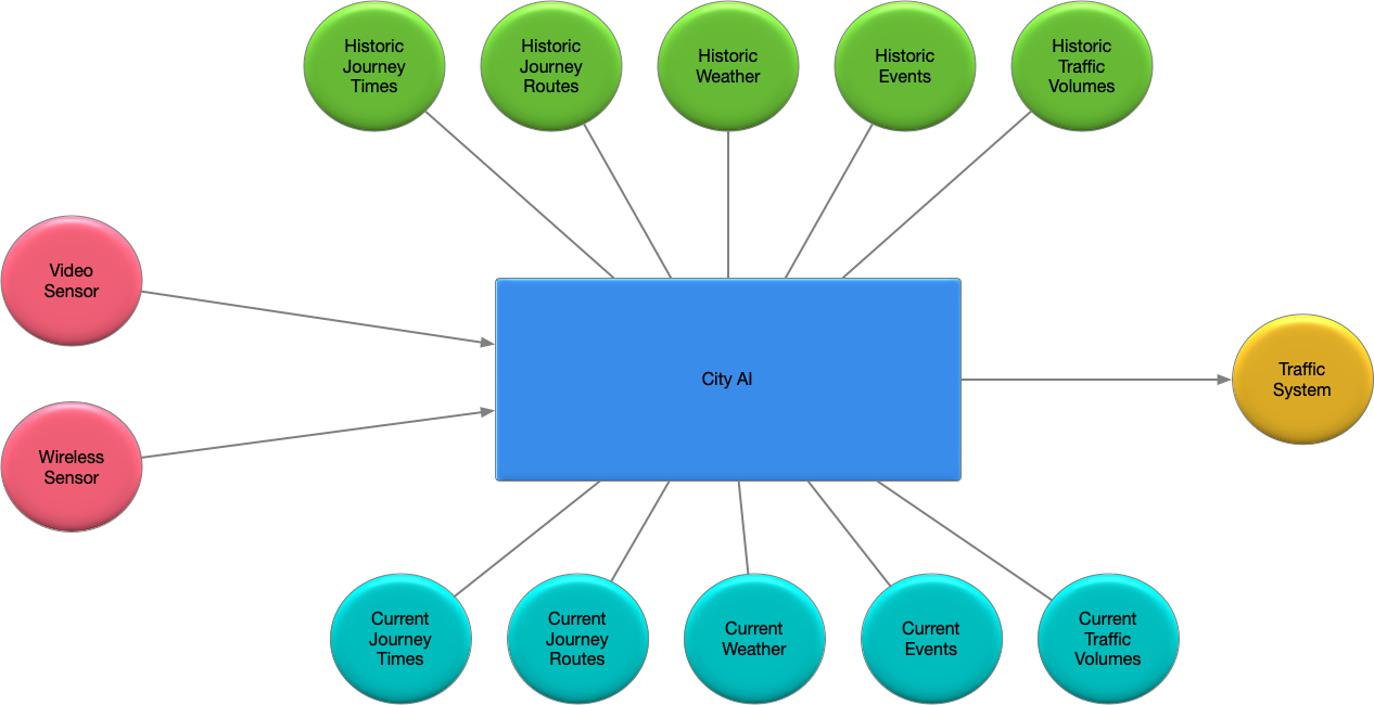
The AI draws on billions of recorded vehicle movements built up over years of city tracking — currently over 10 million transactions collected daily per city, tracking more than 750,000 journeys in many cities. External factors such as weather, events and historical trends are added, so the forecast stays accurate whatever the day brings.
Smart Junctions
Digitisation starts at the junction
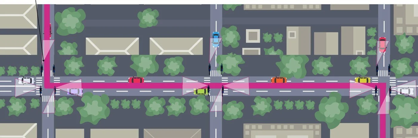
Digital traffic signals use cameras and wireless detectors in place of loops in the road — a typical Smart Junction runs four cameras and a Bluetooth detector on one AI unit, and a single unit can manage three or more connected junctions over a wireless cluster. Virtual loops, Automatic Number Plate Recognition (ANPR), cycle tracking, vehicle classification, turn analysis and journey times all feed the central AI, which interfaces with UTC, UTMC and city managers.
Explore Smart Junctions →
Forecasting
One hour ahead — and three
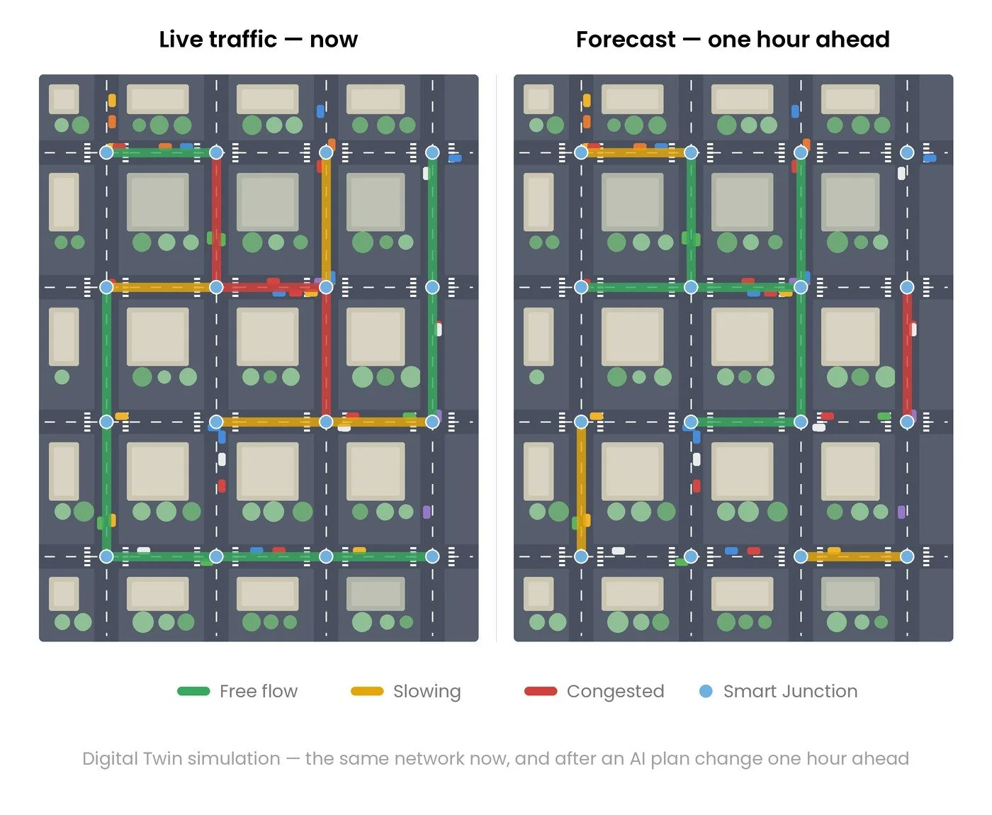
The AI builds a forecast an hour ahead of current traffic from live tracking, historical data, weather, events and other relevant information — the same technology NOW Wireless already uses successfully for air quality forecasting. With sufficient information, one‑hour forecasts can be up to 95% accurate. A three‑hour forecast extends the horizon for evaluating potential issues, with accuracy improving as the system learns from its previous forecasts.
Simulation
See it, change it, roll it out
Simulation software displays the city and its traffic flows — now, in one hour and in three — on a workstation or an augmented reality (AR) headset. Signal timing changes are tested in the model, and where the predicted impact is positive they're rolled out to the traffic controllers. Traffic plan creation and signal interaction can be automated to maximise throughput and reduce pollution.
Get in touch
Bring a Digital Twin to your city
Talk to our engineers about modelling your network — from a cluster of junctions to a city‑wide twin, built on the tracking infrastructure you may already have.