
NOW Wireless
AI
Developed by NOW Wireless, and NOW owns the IP. One trainable AI that counts, classifies and tracks pedestrians, cyclists and vehicles across the city in real time — with built‑in advanced ANPR — on existing or new cameras.
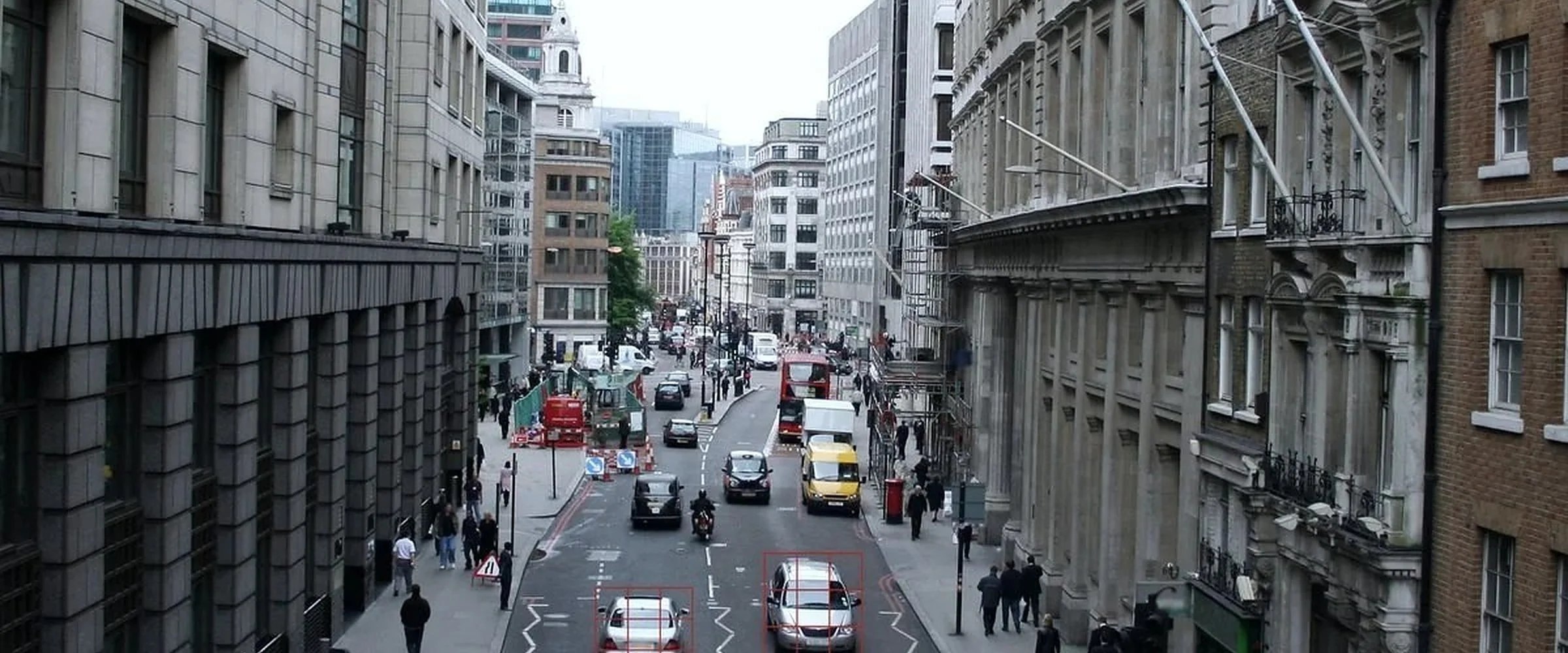
Our own AI
Built here, trained for your streets
This is not a licensed detection engine wrapped in a badge. NOW Wireless developed its own AI for Smart Cities and traffic, and it is a general‑purpose trainable platform — several validated models run on the same unit, and new applications are added where hardware capacity, model validation and camera compatibility allow.
- Runs on any compatible ONVIF‑conformant IP camera — existing cameras can often be reused
- Multi‑model: classification, ANPR (Automatic Number Plate Recognition) and bus‑lane monitoring can share one unit
- Trained per customer, on that customer’s own streets and camera angles
- Full support for Urban Traffic Control (UTC) and Urban Traffic Management and Control (UTMC)
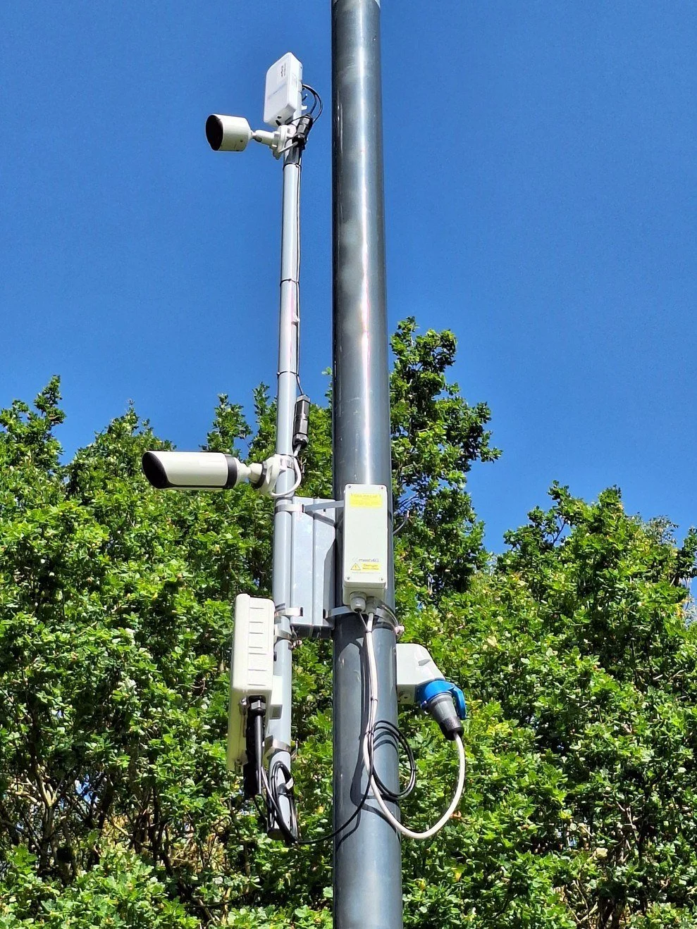
Integrated AI on a street column — real install.
Virtual loops
Detection without digging up the road
Traditional inductive loops are replaced by AI, sensors and a camera — no roadworks, no closures. Virtual loops count and classify pedestrians and up to 17 vehicle types, detect stop‑line presence, identify traffic hotspots and can automatically trigger mitigation.
- Stop‑line presence, approach occupancy and remote virtual loops from one camera
- Zones drawn, moved and resized from the desk — no return visit
- Validated outputs presented to a compatible controller as loop signals or over Ethernet
- Ready for the forthcoming Adaptive Real‑Time Management System (ARTMS) standard, where AI feeds richer detection into UTC and the on‑street controller
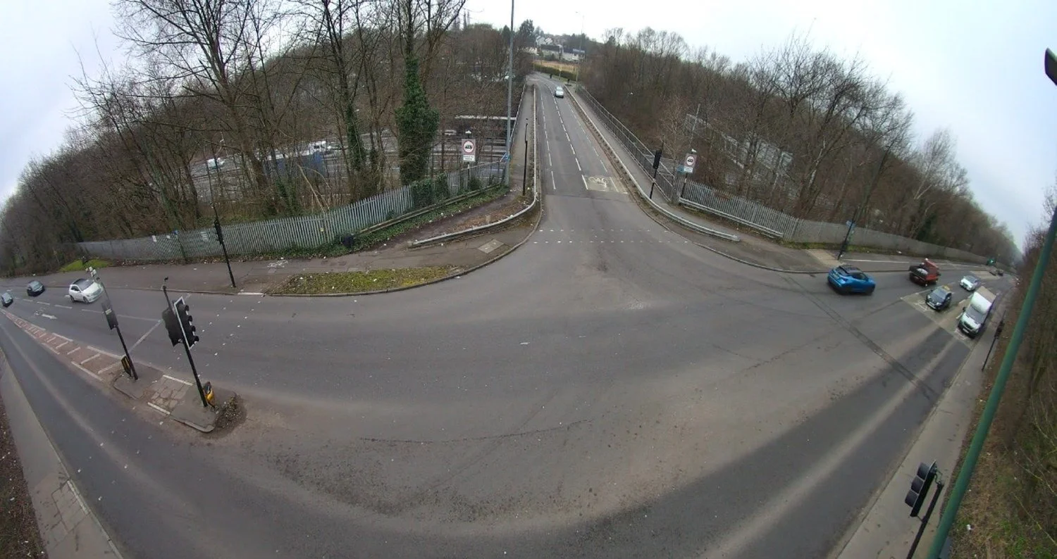
Detection zones drawn on a live junction view.
Count and classify
Every road user, counted and named
Vehicles passing configured zones are counted and classified into up to 17 types, alongside pedestrians and cyclists. Dedicated models recognise buses, taxis and emergency vehicles for authorised priority strategies.
- Pedestrians, cyclists and vehicles counted and classified separately
- Class count depends on camera location and whether ANPR assist is enabled
- Dedicated models for buses, taxis and emergency vehicles, subject to controller integration and operational approval
- Continuous counts replace manual surveys — policy‑ready data output
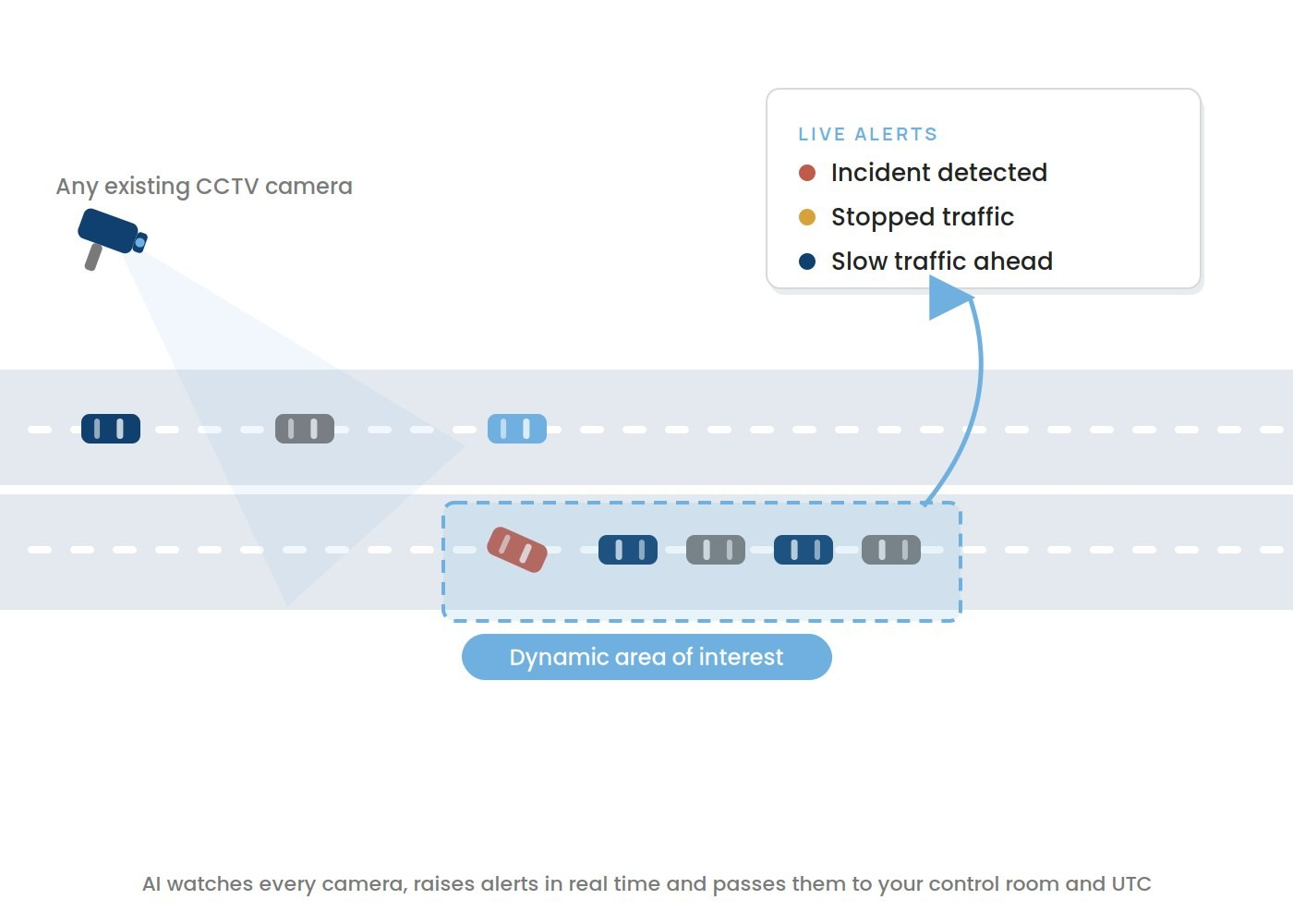
AI watches every camera, raises alerts in real time and passes them to your control room and UTC.
Queue detection
Spot the queue as it forms
Draw a zone on any camera and the AI watches it for queues — no movement, or slow movement, of a group of vehicles inside the box. When a queue forms it triggers an alert to operators or a loop pulse straight to the traffic controller.
- Live queue length measurement, not just presence
- Alert email to operators, or a loop pulse to the controller
- Interfaces to UTC and to the cloud
- Congestion alerts can trigger pre‑approved diversion plans
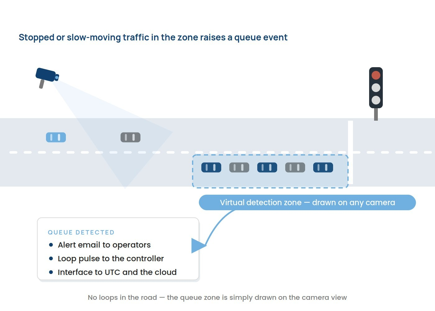
Stopped or slow‑moving traffic in the zone raises a queue event.
Turn analysis
Count every turn at every junction
Vehicles at a junction are counted and classified by the direction they leave. The AI tracks each vehicle through the junction in real time, classifying and counting as it goes, and provides an individual count for every direction you configure.
- Real‑time turn counts on every arm
- Classified counts, not just totals
- An individual count for each configured direction
- Replaces periodic manual turning‑movement surveys
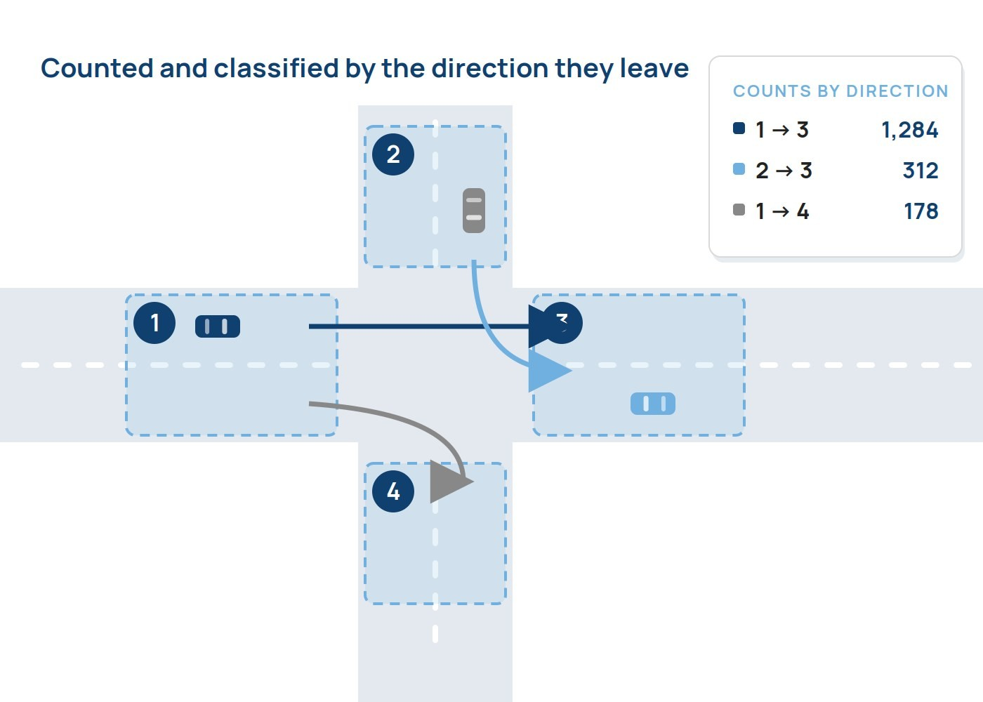
Counted and classified by the direction they leave.
Desire lines
See how the road is really used
Every vehicle’s movement through the frame is tracked and drawn as a trace directly on the camera image, building up desire lines that show how road users actually move through a junction. It is a graphical, at‑a‑glance view of demand that no count alone can give — live in SenseView today.
- Traces drawn on the camera image itself
- Shows turning behaviour and informal pedestrian crossing points
- Reveals routing the junction was never designed for
- Evidence for scheme design, not just scheme monitoring
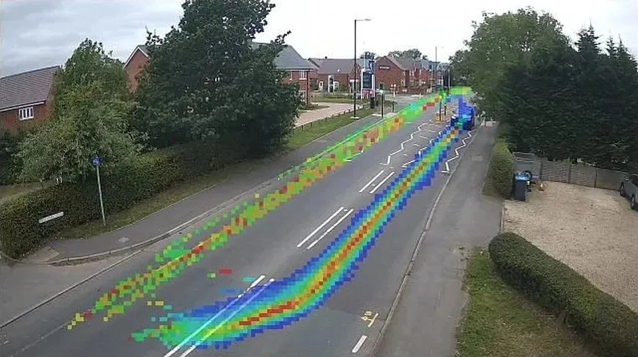
Desire lines built up on the camera image.
Start and end of journey
Know where every journey starts and ends
Anonymous digital signatures show where pedestrians, cyclists and vehicles come from and where they are going. AI analysis of the collected data gives in‑depth insight into road use — device journeys across the whole day, and quick identification of non‑standard routing through streets that were not designed for it.
- Pseudonymous Bluetooth and Wi‑Fi identifiers, aggregated for reporting
- Origin–destination patterns across configured locations
- Rat‑run and diversion analysis
- Journey‑time analysis by class where supporting classification data is available
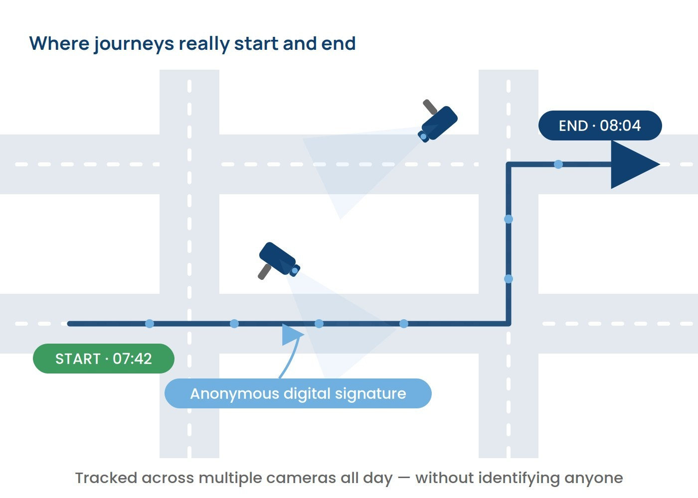
Tracked across multiple cameras all day — without identifying anyone.
ANPR
Number plates, classification and pollution rating
Automatic Number Plate Recognition (ANPR) adds journey times, turn analysis, start‑to‑end journeys and extended classification to any camera. Where authorised, each plate can be checked against national vehicle records, returning the vehicle’s classification, fuel type, Euro status and pollution rating.
- Configured systems designed for recognition above 95%, and above 98% with suitable short‑range cameras
- Short‑range, long‑range and PTZ ANPR cameras; two lanes per camera; radar‑assisted option for speed
- Supports Low Emission Zones (LEZ), Clean Air Zones and road‑user charging
- Alerts for suspected cloned or ghost plates and for authorised vehicles of interest
- Every plate hashed and salted after capture under a customer‑defined retention policy
Ghost and clone plate detection for forces: see the Police page.
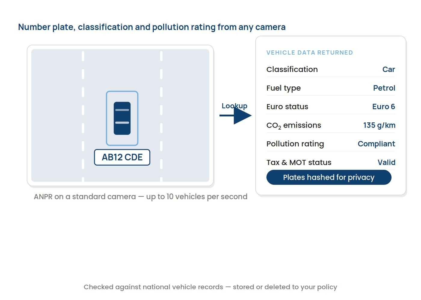
Number plate, classification and pollution rating from any camera.
Traffic monitoring
Intelligent information for traffic managers
The AI watches every camera and alerts operators the moment something changes — slow traffic, stopped traffic and incident detection, with dynamic area‑of‑interest alerting so attention goes exactly where it is needed.
- Slow traffic, stopped traffic and incident detection
- Dynamic area‑of‑interest alerting
- Interfaces to Connected and Autonomous Vehicles (CAV)
- Alerts to operators by on‑screen event, email or message
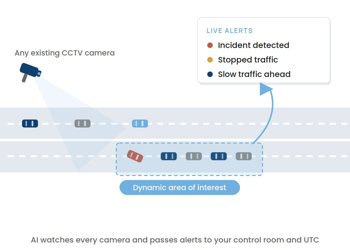
AI watches every camera and passes alerts to your control room and UTC.
Bus and taxi priority
Priority for the vehicles that move the most people
The AI detects a bus and gives it a green wave, delays the light change while a bus is at the stop, and logs cars in bus lanes. Journey times come from ANPR or Bluetooth, and temporary services such as football coaches are recognised too.
- Green wave granted on detection; light change held while a bus is at the stop
- Cars in bus lanes logged with photo for approved evidence workflows
- Bluetooth buttons give authorised buses and ambulances a positive identity
- Interfaces to UTC and UTMC, subject to controller integration and operational approval
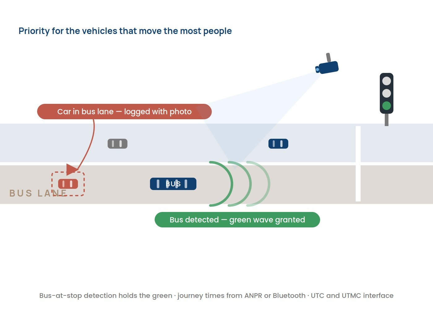
Bus‑at‑stop detection holds the green; journey times from ANPR or Bluetooth.
Parking
The same AI, pointed at a car park
Outdoor and indoor parking use the same platform — counting spaces, detecting free space, reading plates at entry and exit, and turning existing CCTV into a parking management system.
- Outdoor: spaces available, car park full, cars parked, free‑space detection, ANPR
- Indoor: free spaces, guidance, vehicles entering and leaving each floor, people counting, bike detection
- Security: low‑light and infrared, people detection, incident management
- Works locally and in the cloud, and can forward information to existing parking systems
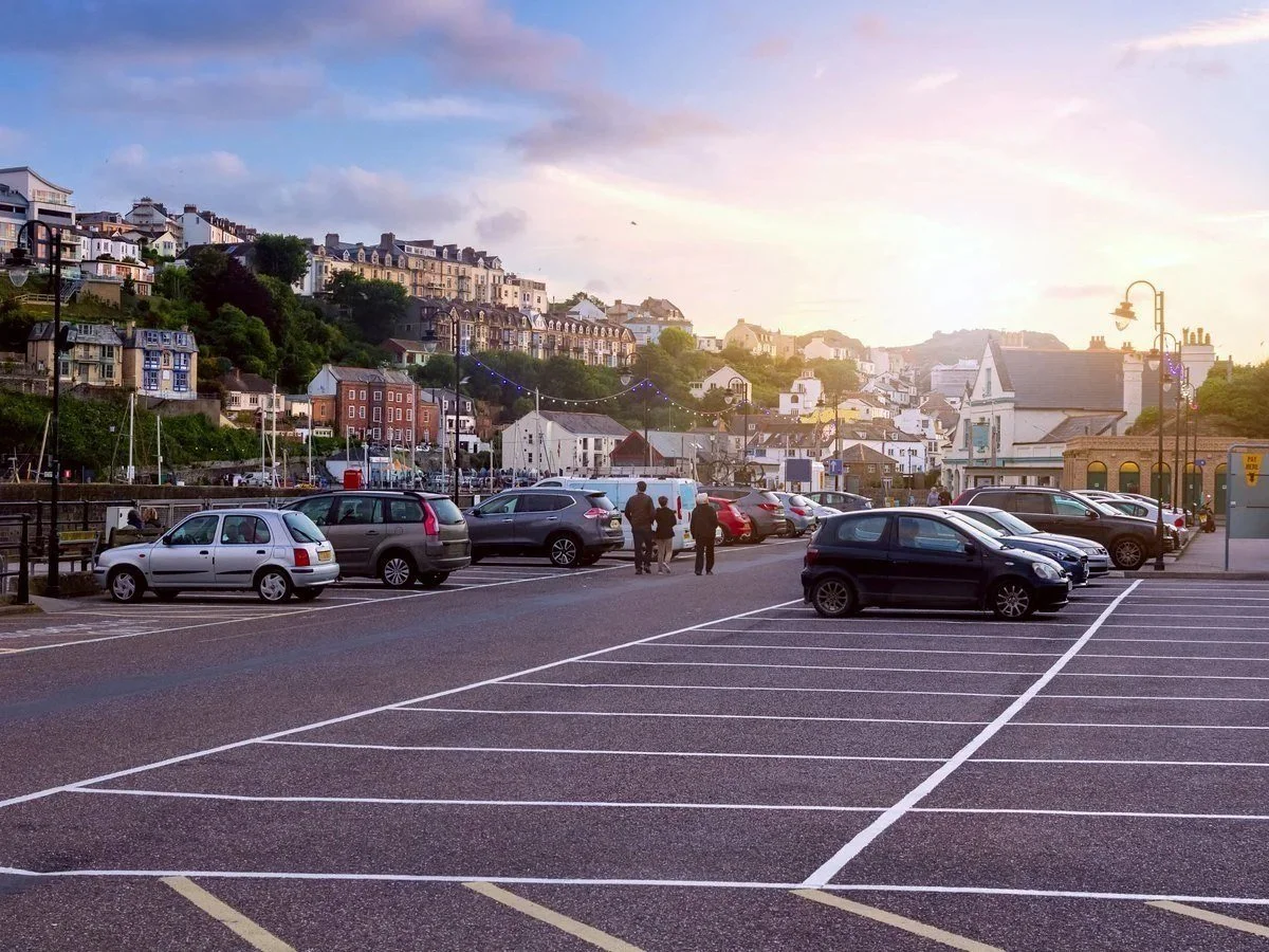
Existing CCTV becomes a parking management system.
Air quality
Predicting pollution, not just measuring it
AI‑powered pollution analysis monitors and anticipates pollution build‑up so remediation can be triggered before a predicted exceedance rather than reported afterwards. The same AI also calibrates the sensors, keeping long‑life pollution monitors accurate without site visits.
- Nitrogen dioxide (NO₂) forecast up to an hour ahead
- In specified trials, forecast accuracy has reached up to 95%
- AI auto‑calibration compensates for electrochemical sensor drift in software
- Supports Low Emission Zones and Air Quality Management Areas (AQMA)
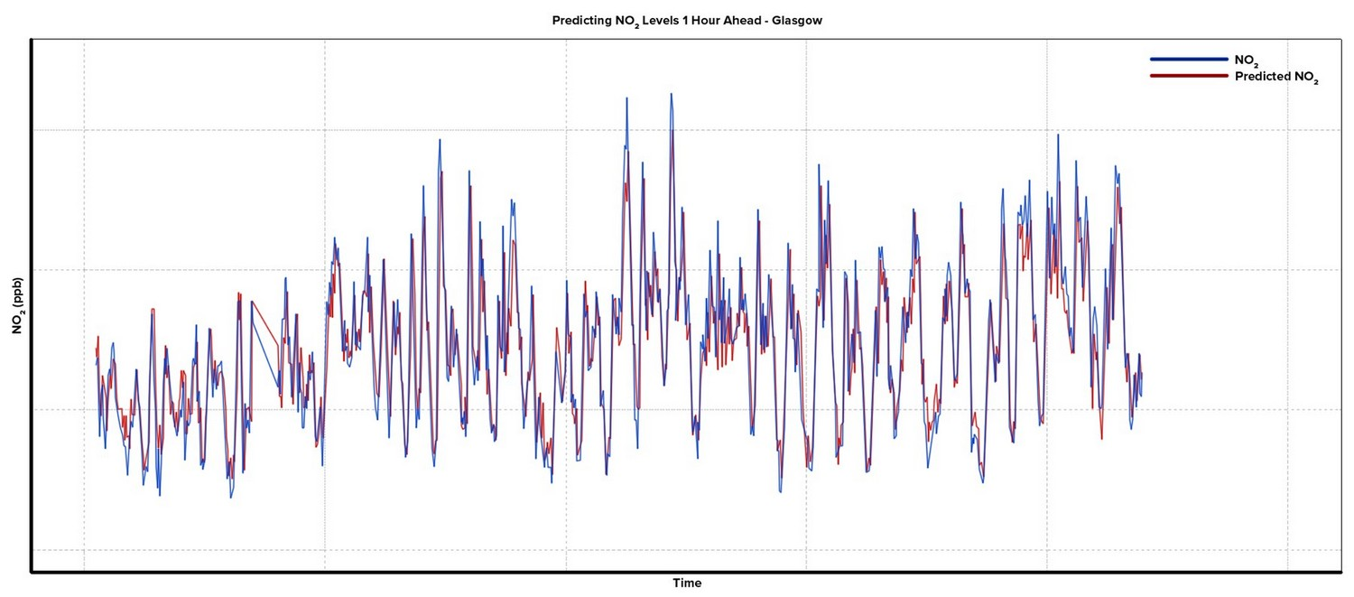
Measured NO₂ against the forecast made an hour earlier.
Where it runs
On the street, in the cloud, or both
Because the AI sits on street as well as in the back office, it can respond in real time — a pollution event can trigger traffic restrictions or green waves as it develops. Compatible units operate as a distributed edge cluster, and everything lands in SenseView, our real‑time database.
- Edge processing at the junction for real‑time control decisions
- Cloud or control‑room processing for analysis, reporting and video
- Units network together as a co‑operative AI cloud
- SenseView can drive and receive input/output pins to create actions — loop outputs, sensor inputs, screen displays, email or message alerts
See the Real-Time Data page for where it all lands.
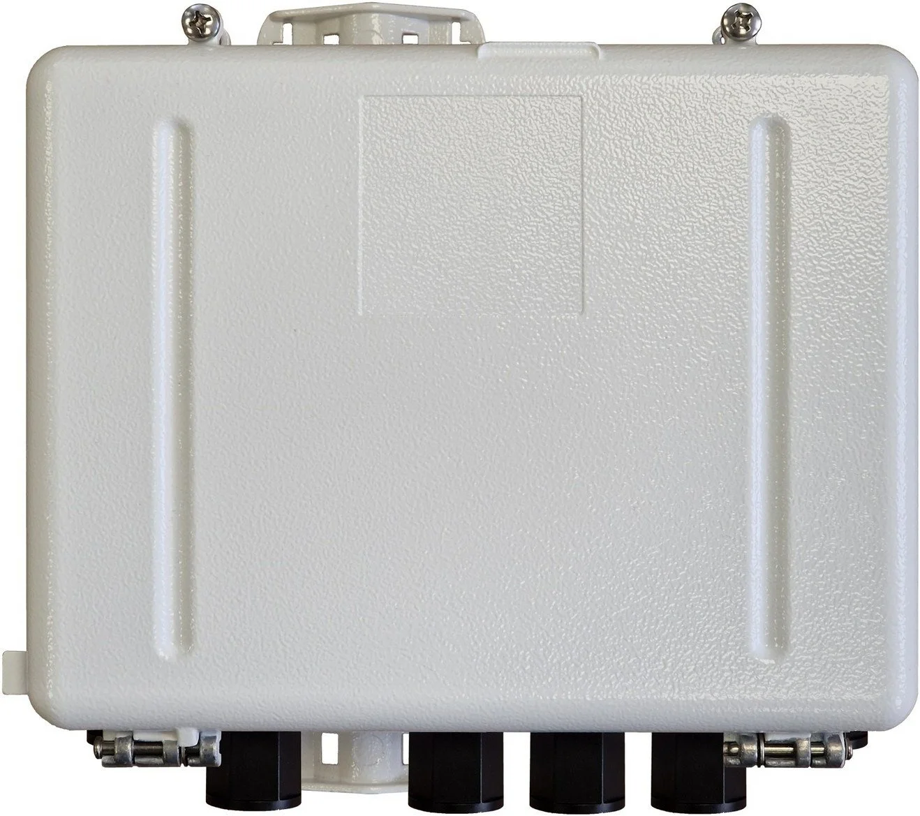
The integrated AI unit: AI, mesh router and Bluetooth detector in one housing.
Get in touch
Try it on the cameras you already have
Talk to our engineers about a trial on your existing cameras — from a single junction to a city‑wide deployment.